Cowans – Colorado Ghost Town
by local author & historian: John LaBorde
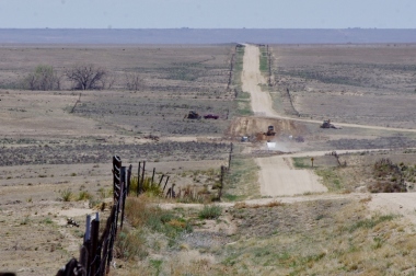
The Cowan’s community covered a vast area. There was the school house, a couple of cemeteries and a church in the area. Here one can take the dusty back country roads and get a peek at life more than a hundred years ago. The roads climb hills showing hope and revealing sorrow. Crossing a ridge, angling across a pasture, the road passes small sand dunes, reminders of drier years when the wind would rearrange the dust and leave it in stacks.
The lifeline of the prairie ushers from the ground, nourishing the grasses, wildlife, and trees that climb towards the clouds as the birds chirp contently in this oasis. A small stream headwaters in the area giving life to a dry parched land. Here CR 10 ends crossing this slash of green. The road winds through the front yards going up to the other side to CR D following the other side of the creek bank. There are other houses nearby looking out over the waving green grasses.
 Cowan’s community Post Office is on wheels. The USGS map shows five different locations for the Post Office. As it moved from ranch house to ranch house, it appears to of kept the name Cowan’s. On the county map it shows a Cowan’s school district in the area. The map shows a Post Office at this junction of CR 10 and CR D. One can see why it would be a great place to settle.
Traveling on west on CR D to the CR 8 junction is the next location of a Cowan Post Office. At the junction of the two county roads are a few cattle grazing in the pasture. Going on west on CR D, one leaves the green little valley behind. It is now mostly rolling gentle lands with a view to the west of Pikes Peak.
There are some ranch houses along the route. When CR D ends at CR 4 is where the map shows another location for Cowan. 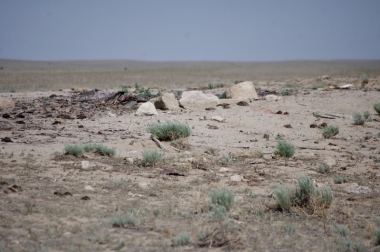 Here there is nothing but a rubble pile and some foundations. This may have been a Post Office/General Store combination.
Today it is surrounded by pasture and empty land. The harsh reality of the Dust Bowl can be seen as your eyes travel the horizon. Sparse grasslands have been scooped out by windy blasts where dust and sand are deposited in small dunes. The dreams of many settlers were dashed by the dirt storms leaving behind abandoned homes.
Making a big loop, one can angle north to CR M, east to CR 5, north to CR J and then west back to the Cowan’s schoolhouse. 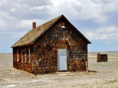
On the SW corner of CR J and CR 10 is the tattered and weathered schoolhouse. Here the families entrusted their children’s learning to a school teacher they hired. It was also a community building for meetings and special events, and the polling place for elections.
Today it sits empty listening to the winds of time travel through the rafters. The rest house out back still stands looking out across the pasture of another day.
Time has traveled on and the ghosts silently sit on the tufts of prairie grasses. The sounds of squealing children silent, and no clanging of a school bell. Here was an era many knew not.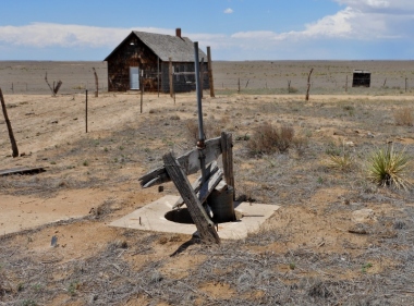 Across the road from the school building are some rubble piles, footers, and a well house. Many of these communities would provide housing for the teacher and this lot may have housed the teacher. You can stand on the hill ridge, watch the clouds float by and listen to the silence. The echoes do not return.
One has made a full circle around the Cowan community. . . . . . . almost. To the east on CR J is a substation and pumping station for a gas line.
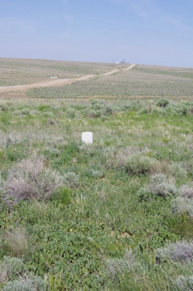
This is where another Cowan Post Office was shown to have been. The station is named Cowan’s substation.Gas now flows underneath where a community Post Office once stood. On the other side of the road are some old corrals and footers from other buildings that once stood in the area. Look off to the east and down in the draw there are some trees. Here in Dead Horse Creek is where yet another Cowan’s Post Office was shown. To the east where CR 12 would have been is the cemetery. It is marked by a gate and there are a few headstones still there. The wooden crosses are long gone.
Cowan gives a classic look back into a time that has long disappeared. The schoolhouse, mail rooms, stores, churches, and graveyards. Families lived out their dreams and many met sorrow. Yet others tenaciously hung on. Ghosts sitting alongside the roads have many stories to tell and so often are not heard.
 CR J goes west from SH 71 and makes a dog leg south a bit then continues passing replaced creek bridges. Up over a ridge to CR 13 and you are in Dead Horse Creek. The road made a curve to cross the creek but the county has straightened out the road at Cowan with a culvert. Here is a grave yard just before the creek. A bit further on is a stand of trees where a ranch house once stood.